GEL 1008
PHYSICAL GEOLOGY |
Physical Geology On-line Lab and Helpful Lab Hints
Exercise 15: Geologic Maps
Problem 1
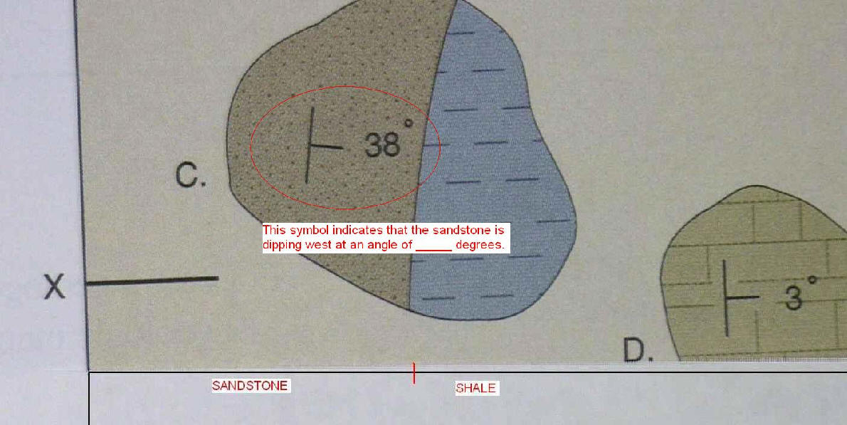
- Plot the strike and dip symbols as indicated below.
- Complete the geologic map by inferring boundaries between the three rock types. Symbols are identified on page 254. Click here for a 1/2 finished version.
- It might help to complete the cross section (d., below) to determine which rock type is on top.
- To make a cross-section from X to Y.
- Transfer the rock types present between X and Y on the map to the top of the cross section box at the bottom of the page.
- Use the strike and dip symbols in outcrops C, D, and B to determine the trend of the rocks below those points. (see below)
- Hint: Follow the sandstone, what happens to the sandstone layer in the center of the map? On the west side? Click here for a 1/2-finished version.
- Compare the map and cross-section to the figures on page 267.
Back to lab 15
copyright © 2020 Mike Phillips (includes all photos)
last updated: 2020-04-04
